Introduction: Mapping the World from Above
Consumer drones have opened new frontiers for aerial mapping, once reserved for professionals with expensive equipment. Today, even hobbyists and small businesses can create high-quality aerial maps using drones equipped with basic cameras and GPS. Whether you’re a surveyor, a real estate agent, a farmer, or simply a drone enthusiast, understanding how to build accurate, detailed aerial maps will give you a powerful edge in visual storytelling and data collection.
What Is Aerial Mapping with Drones?
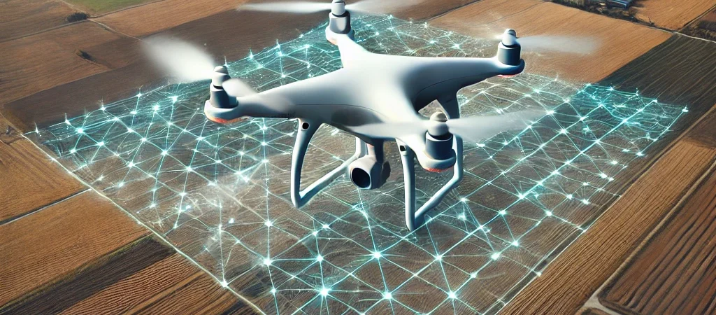
Aerial mapping involves capturing a series of overlapping photos of the ground from above and stitching them together using specialized software. These maps can be orthomosaics—flat, top-down views with accurate scaling—or even detailed 3D models. Drones make it possible to gather this data quickly, safely, and affordably across a wide variety of terrains and project types.
Choosing the Right Drone for Mapping
While high-end drones offer more precision and stability, many consumer-level models today are fully capable of generating professional-quality maps. Look for drones with GPS capability, high-resolution cameras, and stable flight controls. Features like waypoint navigation and automated flight paths are essential for capturing consistent, geotagged images. Popular choices include the DJI Mavic series and Autel Evo drones.
Essential Mapping Software
After capturing the imagery, you’ll need photogrammetry software to process it into maps. Programs like Pix4D, DroneDeploy, and Agisoft Metashape allow users to create 2D and 3D representations of landscapes from a set of still images. Many of these platforms also offer cloud-based processing, making it easier for beginners to start mapping without powerful computers.
Best Practices for Aerial Mapping
To ensure your aerial maps are clear and accurate, follow a few best practices. Maintain at least 70–80% image overlap between photos to help the software stitch them seamlessly. Fly at a consistent altitude and speed, and use automated flight planning tools to maintain precision. Avoid windy or overcast conditions that can interfere with lighting and stability.
Applications Across Industries
Aerial mapping with drones is used across countless industries. In agriculture, it helps monitor crop health and irrigation. Construction professionals use drone maps for site surveys, progress reports, and safety assessments. Urban planners, environmental scientists, and real estate developers also rely on drone mapping for efficient data visualization. Even historical preservation and archaeology now benefit from drone-assisted terrain modeling.
Editing and Enhancing Your Aerial Maps
Once the raw map is generated, refining it can dramatically improve its readability and visual impact. Add labels, overlay data layers, or use color grading to highlight specific features. For presentations or reports, exporting high-resolution images and integrating them with charts or 3D flythroughs can make your content more compelling and informative.
Legal and Safety Considerations
Before mapping any area, make sure you’re compliant with local drone regulations. In Canada, drone pilots must pass the RPAS Basic or Advanced certification, depending on the airspace. Be aware of no-fly zones and obtain permission for flights over private property or populated areas. Always prioritize safety for people and property during operations.
Toronto as a Mapping Playground
With its diverse mix of urban, waterfront, and green spaces, Toronto offers drone pilots a rich canvas for aerial mapping projects. Whether you’re mapping downtown development sites or capturing natural conservation areas, the city’s landscape presents endless opportunities. www.torontodronephotography.com is a go-to provider for drone mapping services in the GTA, offering expert guidance and state-of-the-art equipment for both commercial and creative applications.
Bringing It All Together
Aerial mapping is no longer the domain of large enterprises. With consumer drones and accessible software, you can create stunning, data-rich maps that serve practical and aesthetic purposes alike. From field surveys to visual storytelling, drone mapping empowers users to visualize their world from above with clarity and creativity. If you’re ready to take your aerial imagery to the next level, connect with Toronto Drone Photography to explore your full potential in mapping and beyond.